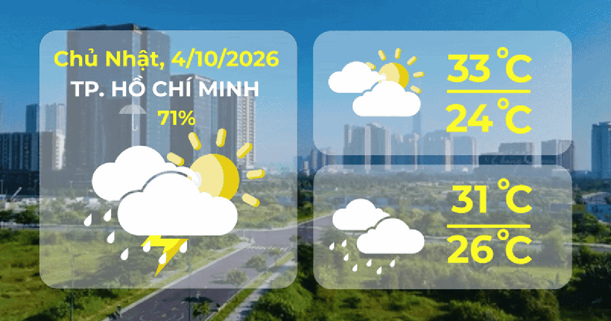

While many areas of Ho Chi Minh City are still recovering from the flooding caused by the recent heavy rains, moderate to heavy rainfall is likely to occur on the evening of October 3rd and may continue for several days.
This development is predicted in the context of simultaneous weather patterns, including the potential formation and increasing activity of a tropical convergence zone from around October 5-6.
According to the 2:05 PM bulletin on October 3rd from the Southern Vietnam Meteorological and Hydrological Station, from 7 PM on October 2nd to 7 PM on October 3rd, Ho Chi Minh City experienced moderate to heavy rainfall, with precipitation generally ranging from 30-60 mm, and exceeding 70 mm in some areas.
Rain will be concentrated mainly in the afternoon and evening, with the possibility of tornadoes, lightning, and strong gusts of wind during thunderstorms; localized heavy rain may cause flooding in urban areas with poor drainage, low-lying areas, and riverside areas.
The meteorological agency predicts that the rainy period may last for several more days, with rainfall generally ranging from 30-60mm, and in some places exceeding 60mm in 24 hours.
Over the next 3-10 days, the low-pressure trough will continue to be compressed and gradually move southward. Around October 5-6, a tropical convergence zone is likely to form with its axis at approximately 12-15 degrees North latitude and will tend to become increasingly active.
Speaking with reporters on the afternoon of October 3rd, Master Nguyen Van Tin, from the Department of Meteorology, Hydrology and Water Resources, Ho Chi Minh City University of Natural Resources and Environment, stated that the rains at the end of September and beginning of October were not simply ordinary convective showers, but rather the result of the overlapping of multiple weather patterns.
The rainfall from September 12-25 was associated with a low-pressure trough that later strengthened into a tropical convergence zone, connected to a low-pressure disturbance moving inland from the sea. In late September and early October, easterly wind disturbances from the northwestern edge, and then the southern edge of the high-pressure system shifting its axis from the South China Sea down to Southern Vietnam, along with other weather patterns, created favorable conditions for strong convective cloud development.
From September 30th, a cold front swept down into Northeast Vietnam, connecting with a high-pressure system over the sea to create a high-pressure ridge, pushing the convergence zone from Central Vietnam southward. Easterly winds on the southern edge of the Western Pacific high-pressure system converged with southwesterly winds from the Gulf of Thailand , creating conditions for the formation of strong thunderstorm clouds, causing heavy rain.

According to Master's degree holder Nguyen Van Tin, these weather patterns causing rain are not unusual and have occurred in Ho Chi Minh City over the years. However, when multiple patterns interact, the likelihood of forming strong thunderstorms and causing heavy rainfall increases. The concentration of rain in the late afternoon and evening is also consistent with the tropical convection mechanism. During the day, the ground and urban areas heat up, convection gradually develops and is usually stronger in the late afternoon and evening; the urban heat island effect may further accentuate this process.
The recent rainfall coincided with high tides both in the morning and evening, limiting drainage capacity and contributing to the worsening flooding situation in Ho Chi Minh City.
According to the Southern Vietnam Meteorological and Hydrological Station, from 7:00 AM on September 29th to 7:00 AM on October 2nd, the Le Minh Xuan station recorded a total rainfall of 366.6mm. Many other areas also recorded rainfall exceeding 100mm.
Meteorological experts believe that El Niño is a large-scale climate signal that, on average, causes rainfall deficits in Southern Vietnam, but this signal alone cannot be used to accurately predict an extreme rainfall event in a particular locality. Under strong El Niño conditions, the total seasonal rainfall may be low, but the rain is likely to be concentrated in a few periods with high intensity.

According to the trend for October, the total rainfall in Southern Vietnam is generally lower than the multi-year average, with the National Center for Meteorological and Hydrological Forecasting estimating it to be about 5-20% lower.
Rainfall tends to be heavier during the first and middle weeks of the month, then gradually decreases towards the end of the month. Southern Vietnam is likely to experience 1-2 periods of heavy rain and 1-2 tropical cyclones in the East Sea. When there is a typhoon or tropical depression in the East Sea, the southwest wind may strengthen, increasing rainfall in Southern Vietnam.
Therefore, during the early and mid-October period, rain remains the main factor to monitor in Ho Chi Minh City. Towards the end of the month, when rainfall tends to decrease, high tides will become a significant factor contributing to the risk of flooding.
The predicted peak tides on October 27-29 could reach 1.7-1.75m at Phu An and 1.82-1.87m at Thu Dau Mot, both exceeding alarm level 3. When river water levels are high, drainage from the sewer and canal systems will be difficult. In low-lying areas and along the riverbanks, moderate to heavy rain coinciding with peak tides could increase the risk of flooding.
Given the ongoing thunderstorms, the meteorological agency advises people to regularly monitor weather warnings, especially in the late afternoon and evening, to proactively prevent tornadoes, lightning, strong gusts of wind, and localized flooding.
Source: https://www.vietnamplus.vn/tp-ho-chi-minh-con-mua-nhieu-ngay-dai-hoi-tu-nhiet-doi-co-xu-huong-manh-len-post1139858.vnp